


Enhancing Urban Development with Cutting Edge 3D Visualization
Explore how 3D visualization improves urban planning, helps reduce errors, and supports smart, sustainable city development.

Urban areas are growing fast. With more people moving into cities every year, the need for smart and well-planned development is greater than ever. Traditional planning methods like flat drawings and blueprints are no longer enough. That is why 3D visualization has become an important tool in modern urban planning.
In this article, we will explain what 3D visualization is, how it helps urban development, and why city planners, architects, and developers are using it to build better and smarter cities. You will learn about its benefits, real-world uses, and how this technology is making the future of cities more efficient and people-friendly.
What Is 3D Visualization in Urban Planning
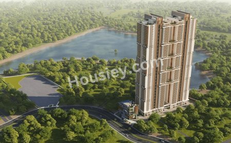
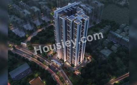
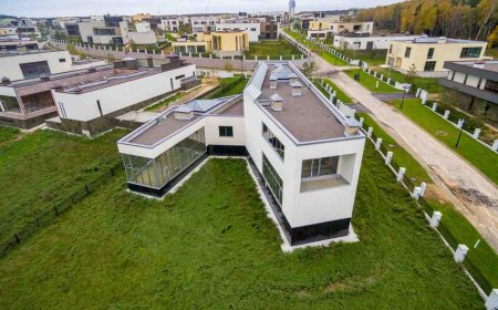
3D visualization means creating digital three-dimensional models of spaces such as buildings, roads, parks, and entire city layouts. These models show how a place will look before anything is built. They offer realistic views from all angles including bird's-eye and street-level perspectives.
This makes it much easier to understand what a project will look like in real life. You can see sunlight direction, building sizes, greenery, pathways, and even how people will move around. It feels like visiting the future.
Why Urban Development Needs 3D Visualization
Urban development is not just about building structures. It is about designing better lives for people. This includes traffic flow, green spaces, schools, hospitals, housing, and how these all connect. 3D visualization helps by making complex plans easy to understand and more accurate.
Better Communication
Many people cannot read technical drawings or blueprints. But when they see a 3D model or animated video, they instantly understand the idea. This helps city officials, investors, and the public see the big picture and make better decisions.
Fewer Mistakes
With 3D models, planners and designers can find problems before construction begins. They can test different options, check safety issues, and fix errors early. This saves time, money, and effort later.
Faster Approvals
When decision makers can clearly see how a project will look, they are more confident and quick to approve it. The planning process becomes smoother and faster.
Public Involvement
Using 3D visualization, communities can join the planning process. People can view the project online or through virtual tours and give feedback. This builds trust and helps make better cities for everyone.
Main Benefits of 3D Visualization in City Projects
Using 3D visualization in urban development offers many useful advantages
Simulating Real Situations
You can simulate how traffic will flow, how sunlight will fall on buildings, and how people will move through the area. These simulations help plan safer and more efficient spaces.
Supporting Eco-Friendly Design
3D tools can be used to test green ideas like rooftop gardens, water-saving systems, or solar panels. You can see how they will work in real-world conditions before installing anything.
High-Quality Design
3D visualization creates lifelike models that look beautiful and clear. These visuals are great for marketing, community meetings, or project pitches.
Saving Time and Money
When everyone understands the design from the beginning, fewer changes are needed later. This makes the project move faster and reduces extra costs.
Where 3D Visualization Is Used in Urban Projects
This technology is already being used in many types of city planning projects
-
Designing smart cities with modern technology
-
Upgrading old neighborhoods into modern communities
-
Planning housing, shopping areas, and offices together
-
Improving public transportation and traffic systems
-
Building schools, hospitals, and community centers
In all these cases, 3D visualization helps bring ideas to life with more accuracy and impact.
Modern Tools That Make 3D Visualization Even Better
Several advanced tools and methods are making 3D visualization more powerful
Artificial Intelligence
AI can predict how people will move through a space and suggest better layouts. This helps create smarter cities that work for everyone.
Drones and LiDAR
Drones capture real images of areas while LiDAR uses laser scanning to measure land and buildings. Together, they create very accurate models of real places.
Virtual and Augmented Reality
These tools let people explore a project as if they are walking through it. You can visit a building or park virtually even before it is built.
Digital Twins
A digital twin is a live 3D model that updates with real-time data. It helps manage cities better by tracking changes like traffic, pollution, or energy use.
How to Choose a 3D Visualization Partner
If you are planning a development project, choosing the right 3D visualization team is very important. A good partner can make your ideas clear and professional.
Look for a team with
-
Experience in city and architecture projects
-
Modern software and skilled artists
-
Clear communication and on-time delivery
-
A creative and detailed design style
One of the trusted names in this field is 3D architectural rendering services. They help planners, developers, and architects turn their ideas into clear and powerful visuals. Their services can improve your presentation, speed up approvals, and help you connect with the community.
What Is the Future of 3D Visualization in Urban Planning

The future of 3D technology in city planning looks bright. Here are a few trends to watch
-
Real-time 3D models that change as the city grows
-
Mobile apps for citizens to explore city plans from home
-
Virtual meetings where people walk through future projects together
-
Smart city platforms that use sensors and data to update plans live
As cities continue to grow, these tools will help create places that are not only beautiful but also more livable, safe, and connected.
Conclusion
3D visualization is changing the way we plan and build our cities. It helps everyone involved from architects to local residents see the future clearly. This leads to better decisions, more support, and smarter urban development.
Whether you are planning a building, a park, or an entire district, using 3D visualization can make your project easier to understand and more successful.